Northern Italy - From Rome to Verona
May 2022
The trip had been a long time in the making. Four years earlier, I had set off in Catania, Sicily, with the idea of getting as far North as possible within a week's time. I was quietly confident that, if only everything worked out perfectly, I could get all the way, that is within shouting distance of Austria. With Italy being just over 1000km long and rather rugged, this would have been no mean feat. In the end I barely made it to Rome but enjoyed the trip so much that it was clear I would one day resume the journey.
Depending on the compartment you choose, the OEBB nightjet to Rome can be a more or less convenient mode of travel! The couchette fits 4 and 6 berths, the pricier sleeper cabin gives you more privacy (and room to stow a bike). Mine was a 6-berth couchette shared with three other young men, who needlessly boarded the train at the last possible stop before it headed into the dark. Suffice it to say that it was a terrible squeeze and that the morning coffee only added insult to injury. As the train pulls into Roma Termini around 11am, I feel less than ready.
Day 1: Rome to Antrodoco
100km943m ↑
The track on google maps
Leaving a big city by bike is always fascinating. The change in scenery is so gradual, and at least initially so subtle, that one can be forgiven thinking one is not making much progress. It's a long time until the urban scenes begin visibly to recede, only to give way to this most peculiar of zones which is no longer city nor properly countryside, a barely habitable zone that tends to form along the main roads protruding out of the big cities. It's where the worst of both worlds come together. It's much longer still until the only visible sign of organised human life is the road ahead.
The first day I often find very challenging, because my typical training distance is a mere 40km on a sunny day. And those extra 8kg on the back make a huge difference too, not so much on flatter terrain, but as soon as the road goes up, you feel the extra Watts - around 10% give or take. That said, I wouldn't change the Deuter Cross-Alps for anything else. It's still a heck of rucksack for one week rides.
From Rome there are, broadly speaking, three ways to the North: a relatively flat run along the coast on the SS1, further inland through rolling hills along the river Tiber towards Perugia, and then the detour further to the East through the Appenine mountain range. I chose the latter since I wanted to explore the Monti Sibellini National Park 200km North-East of Rome. Since I only had a few hours left (it was mid-day by the time I arrived in Rome), my goal was to get roughly half the way there. The Via Salaria or SS4, once found, is easy to follow, though for the first hour is extremely busy and not all that pleasant to ride. The scenic value is low at first until suddenly some snow-capped mountain peaks in the distant North come into view. After 35km at Passo Corese, the road begins to climb out of the Tiber valley over a succession of two hills, the second of which is almost 10km long and unrelenting, a real shocker for the untrained. Shortly before Rieti the SS4 becomes a motorway and disappears in a tunnel. Better take the quieter country lane (the SS4bis, bis from Latin twice indicates that this is either a newer or an older version of another road with the same name, typically going in the same direction) which runs around the hill and then straight into Rieti.
The SS4 meanwhile leaves the town to the West by cutting through another hill and the bike-friendly alternative is not obvious. I find a road that appears to be going in a similar direction, the Via Borgorose, except it's formidably steep and narrow, and turns out to be a one-way lane with me against the honking rest. Luckily, there's only one or two cars coming my way and I re-emerge on the other side unscathed. The real deal is to stay on the SS4bis which takes a wider turn North of the Via Borgorose and which later joins the SS4 at Radicara.
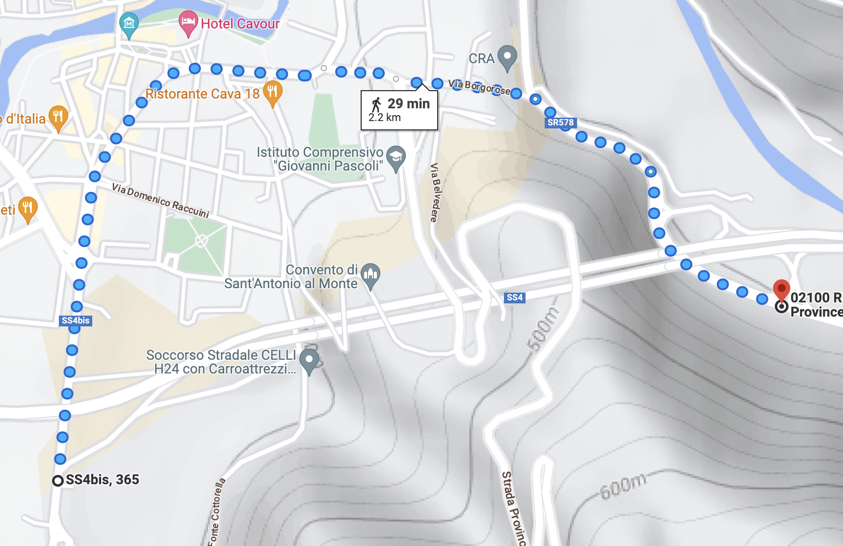
Getting lost in Rieti.
On the other side, it's a relaxed stretch of road through the Velino valley all the way to Antrodoco. Once a major hub on the Via Salaria, Antrodoco is now a small town of barely 2000 people but with a sort of dignified air about it. The range of accommodation options is minimal. There is exactly one place, a very economical hostel with communal rooms and popular among seasonal construction workers from abroad. My room has beds for 20, but I have it all to myself. Compared to the 6-berth sleeper cabin the night before, this is a massive upgrade.
The town doesn't see many tourists. Most visitors come in the summer months and are fellow Italians fleeing the scorching heat of the capital. At the wonderful, well-hidden L'Osteria di Ianus, I am the only diner. Ianus tells me about the wolves that are increasingly seen in the area and, perhaps sensing my unease, is quick to reassure me that they tend to be of the timid variety.
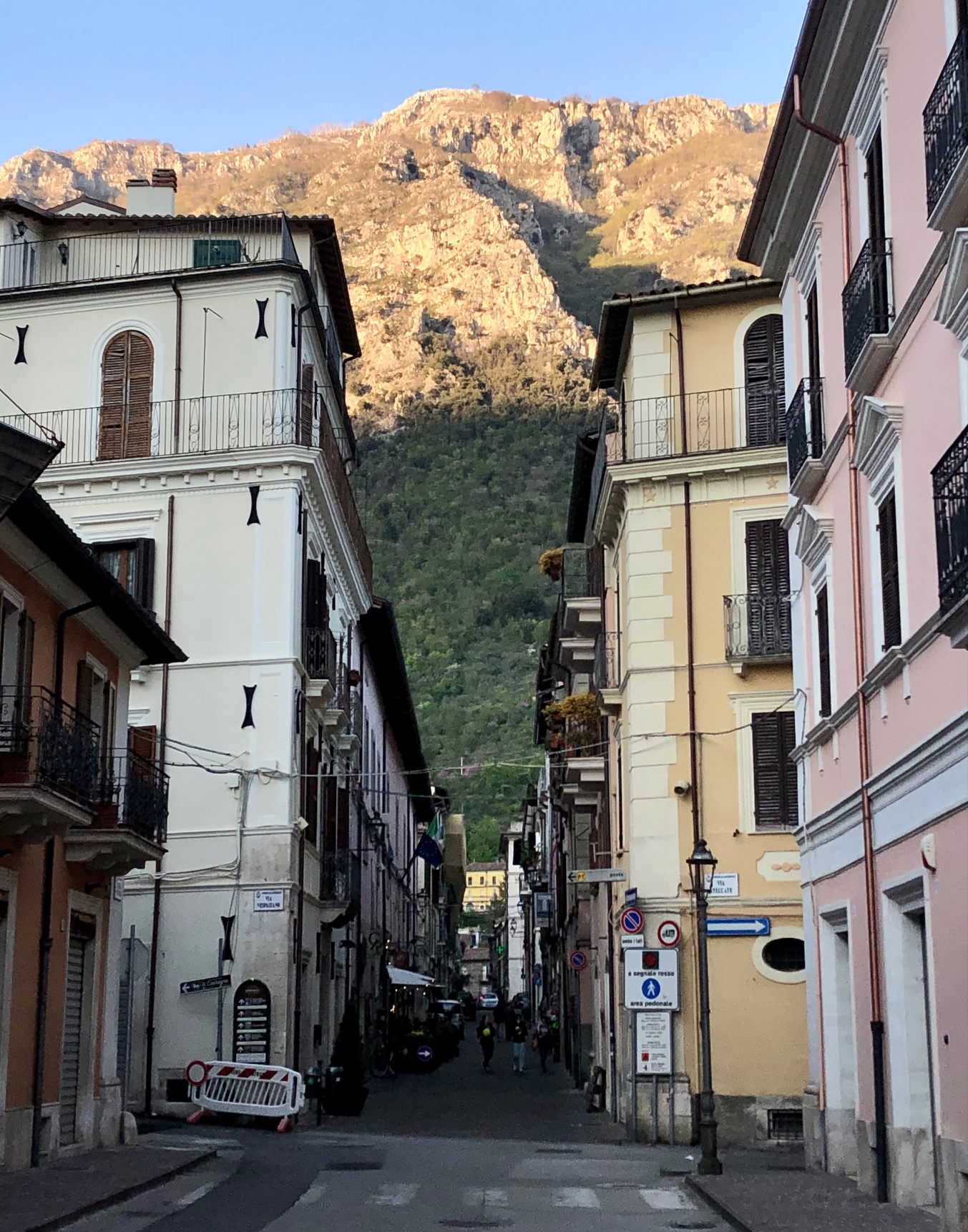
Arriving in Antrodoco. The four-storey houses hail from a bygone era.
Day 2: Antrodoco to Castelsantangelo sul Nera
98km2020m ↑
The track on google maps
Beyond Antrodoco towards the East, the valley narrows to form the Velino gorges. The road frequently pays tribute to the change in topography and disappears in a succession of poorly-lit, alternatingly one-way tunnels. The timings of the traffic lights are such that motorised traffic can easily make it through. On a bike, you have a race on your hands each and every time. Little does it help that the road often goes up.
The fun begins a few kilometers after Posta when you have the first opportunity to leave the main road in favour of a much more tranquil country lane. A few kilometers further still, in Pallottini, it's time to leave the Velino valley and head up North towards Norcia. It's the first bigger climb of around 10km length albeit it with modest gradients, followed by a long and fast descent into Norcia where the 17km rise up to the plains of Castelluccio begins. Knowing what's in store, I decide that now is a good time for a siesta and pull out the light-weight hammock which I brought along for the trip - in case I somehow don't find a place to sleep.
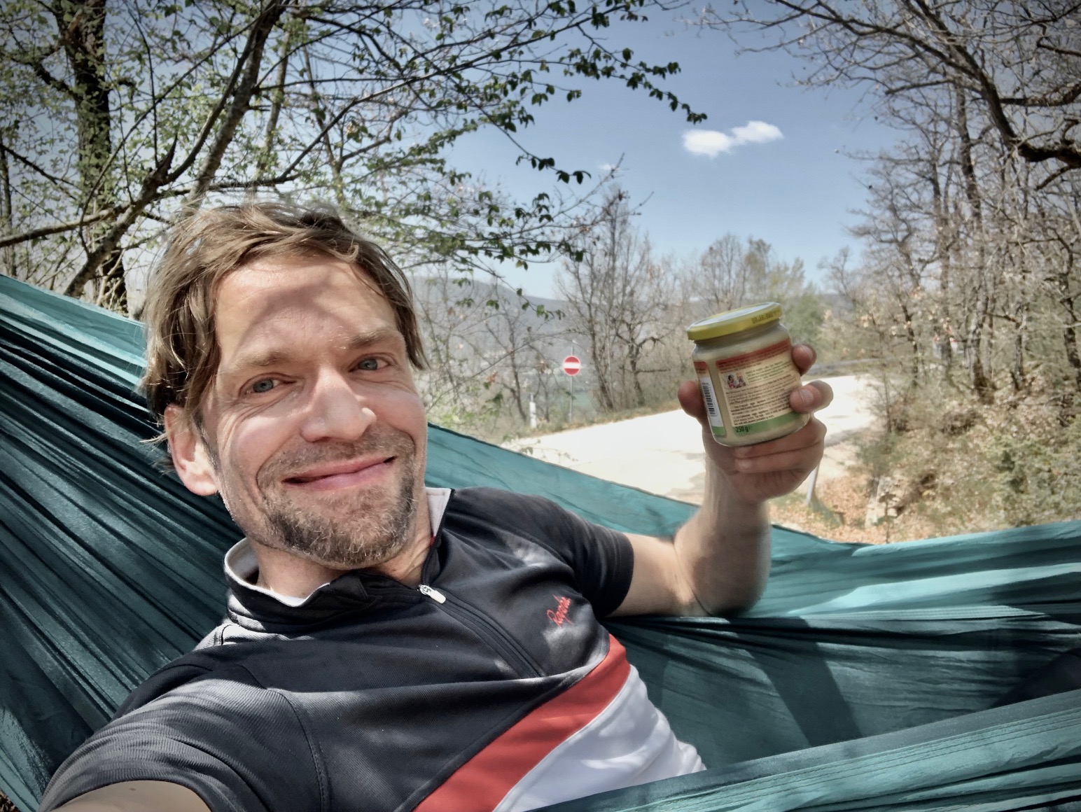
Was it a good idea to bring a hammock along? I would say, except for this one occasion, probably not. It affords some peace of mind but it's still an extra kilo to carry.
The gradients to the top are fairly benign. The road rises steadily at an average of 5% and some steeper sections of around 9%. It's just very long and the views are fairly limited: perfect ingredients for a distraction-free grind.
Climb towards Castellucio
At the top, the view extends into and across the Piano Grande, the great plain that lies at 1270m flanked on all sides by the Sibelline Mountains. Before you get to Castelluccio, you have to first descend to and then traverse said plain along an arrow-straight road. It's around 5km but perceived as twice as long when there's a headwind. Once on the other side, you are still not done until a final, fairly steep climb up to Castelluccio - sitting as it does on its own little hill overlooking the plain. It suffered badly from a number of seismic events in 2016 and 2017 (not the earthquake from 2009 which levelled much of nearby L'Aquila) and the village, never populous anyway, is now a shadow of its former self.
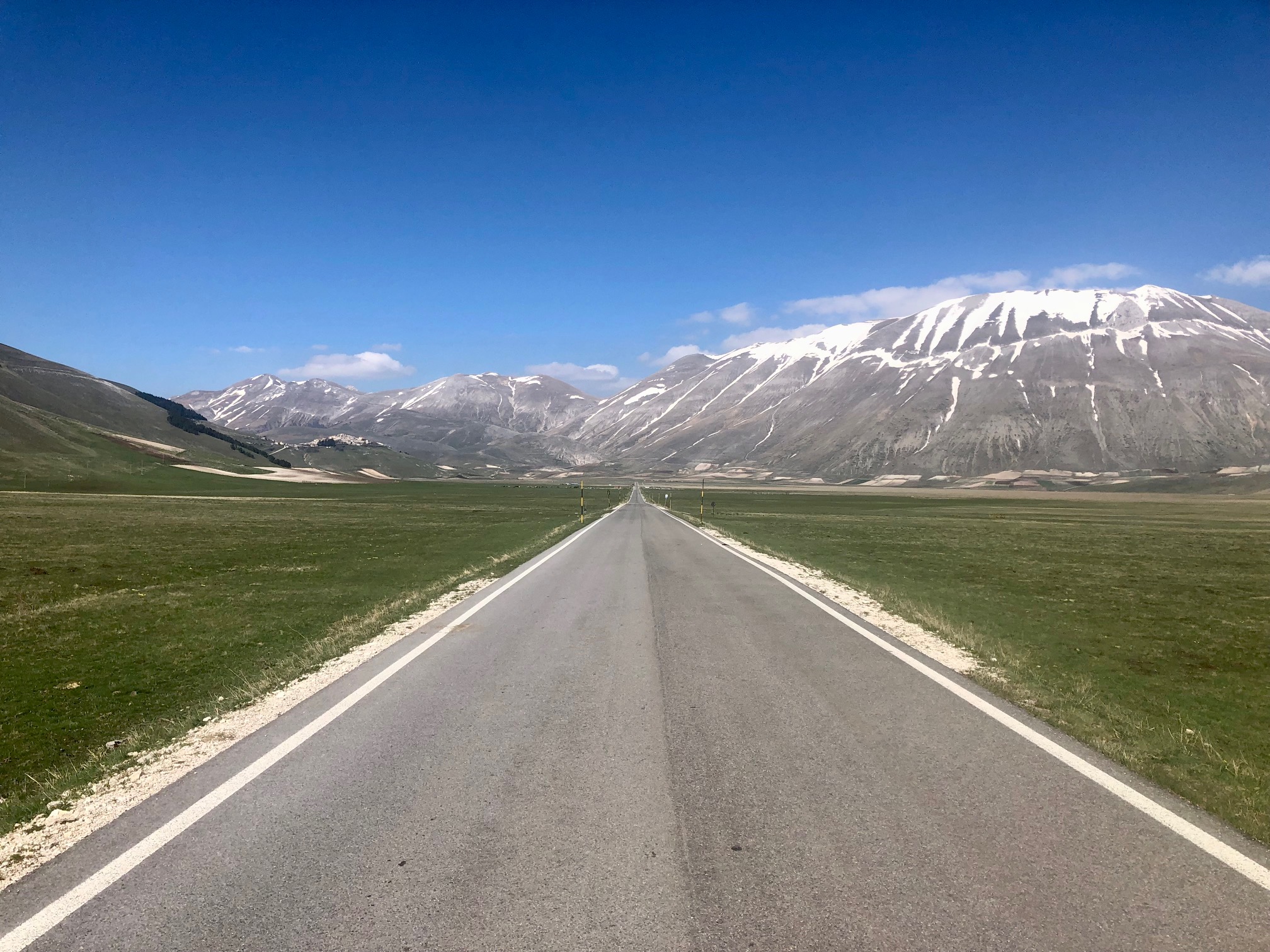
Inside the Monti Sibillini National Park with Castelluccio to the left and the Monte Vettore to the right. Pretty plain, windy and cold at the end of April. If you want to see la fioritura, June would be a better time.
Castelluccio sits in the middle of the plain, not on its flanks. To get out of the Piano Grande, you run through the same sequence as before, just in reverse order and everything one size smaller: a short descent into the plain, a much shorter traverse and a little climb up onto the rim. The descent on the other side is fast and furious and a nice way to conclude the day. The first village on the other side of the national park is Castelsantangelo sul Nera, the epicentre of one of the above-mentioned seismic events. When I ask the residents for a nice place to stay, they shrug and point to a place in the direction I came from. "You don't have much choice, there is only one place". It's called "Dal Navigante", it has a private room, a shower and a restaurant. I need nothing more.
Day 3: Castelsantangelo sul Nera to Lago Trasimeno
126km1130m ↑
The track on google maps
If the first day is tough, the second is often tougher still, and it's only on the third when the cumulative training effect becomes noticeable and things, for the leisurely cyclists that is, begin to turn. It's noticeable in at least three ways: you have decidedly more strength, a little less more endurance and more subtly, the whole system - mind, body and bike - seems to be operating with greater efficiency. Water now becomes just as effective a propellant as a Coke was on day one.
The day starts with a pleasant descent to Visso (600m asl) followed by a little climb up to the Passo delle Fornaci (815m asl), a great way to get the legs spinning. A fast and fun descent to Pieve Torina (500m asl) and the most scenic part of the entire trip begins. It's a country lane, the SP96, that runs to the West of Pieve Torina 10km up an enchanting little valley, rising all the way to 1200m. Traffic is virtually absent as cars tend to take the much faster route further North. It's during the last 2 or 3 steepest kilometers that I have my first encounter with other cyclists. They approach from behind, are ostensibly in better shape since they casually converse without seeming at all out of breath. I have to dig deep to reach the top ahead of them, but only just, so instead of regathering myself I race on. As I do, spinning my legs furiously, one of them draws level, with obvious and only slightly exaggerated ease (was he even pedalling!), looks at me from the side and with a grandfatherly voice (I reckon he must have been in his late 60s) approves of my efforts: 'Complimenti' he says and before I can say anything waves good-bye and turns left onto another road.
I arrive in Colfiorito utterly spent. Colfiorito, which one might translate with "flowery hill", is the first town in Umbria and it's buzzing with cyclists, hundreds of them in groups of all sizes with bikes one more beautiful than the next. No wonder, it's Saturday. But not only that. The land has begun to take on a different character. It feels far removed from the remote wilderness of the Monti Sibellini, only an hour away. Here, where the Apennines give way to the rolling hills of Umbria and then Tuscany, the contours are softer, the colours warmer, and every few kilometers there is a village, a town even, often with more than one cafe to choose from. It's a cyclist's paradise.
After Colfiorito the road meanders across a verdant plateau, the Altopiano de Colfiorito before finally descending spectacularly into Foligno - a drop in two steps of around 600m. When you reach the bottom, you know you have finally arrived in the heartland of Tuscany as we know it. Except it's not Tuscany but Umbria. Its capital Perugia is my next waypoint another 40km away, but only after an improvised lunch on the side of the road, a croissant from 'Dal Navigante' washed down with a few spoonful of cashewnut cream.
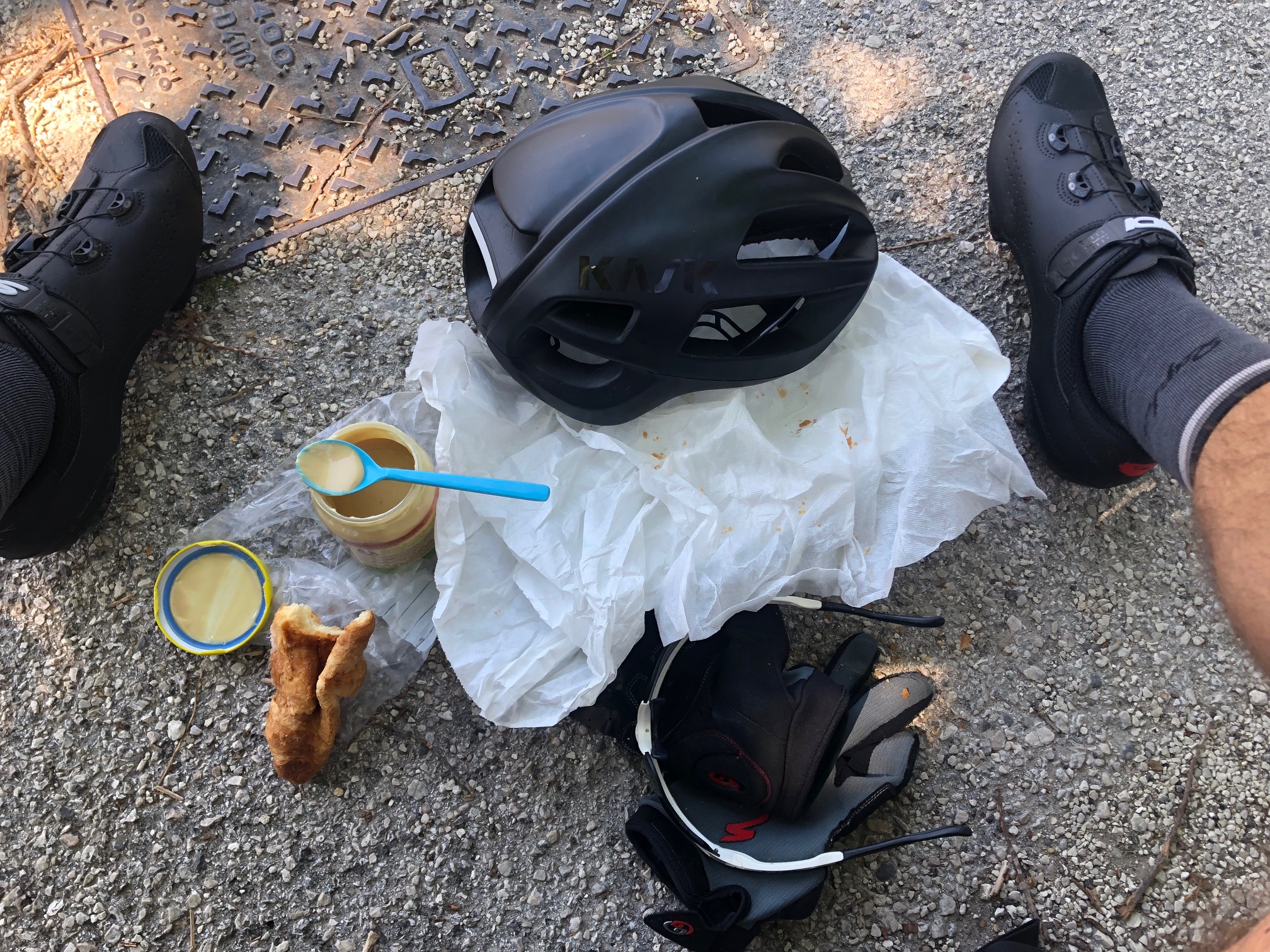
Happiness distilled
The road is flat but it's nevertheless a very long and arduous 40km as the temperature climbs into the high 20s. The road zigzags its way along the broad Valle di Assisi. Hundreds of short segments, every junction a question mark. This means dozens of stops to bring up google maps on my phone, and more often than not turning back to correct my mistake. No such problems on the SS75 just South except it's not meant for bikes.
A brief escape from this gnarly situation is the unmissable "Favorita Osteria Emiliana", not only for its gnocchi with asparagus. It's an immaculately arranged space with beautiful outside seating and a view across the fields towards the first lumps of the Pre-Appenines. Guests are dressed very fashionably (no shorts for the men) and my less than pristine cycling attire raises a few eyebrows.
Once refueled, it takes a special effort to find what was arguably the least scenic stretch of road, the Via della Valtiera, a rough lane that runs right alongside the big E45 albeit only for 2km before you leave the highway via the small Nuovo Ponte Vecchio (the new old bridge that is, which I suppose just means the old bridge needed a revamp or perhaps was completely rebuilt at the same site) over the Tevere river at Ponte San Giovanni.
On the way North, there is absolutely no need to go through Perugia's old town which sits on a nasty hilltop and which, if you insist, can be reached, for example, by first following the 5km long and serpentine SS75bis. That road actually skips the last 100m altitude gain and neatly cuts through Perugia just South of the city center and from there out and East towards the Lago Trasimeno. Of course, if you lack navigational aids, you can continue further up the hill via the Via Romana and descend back into the new town via narrrow, twisty roads and 18% slopes. Not recommended until you want to visit the old town that is.
The road out of Perugia passes through the same stretch of post-utopian scenery, half-industrial, half-abandoned, always somehow ugly. A derelict petrol station with some rusty old office chairs scattered about is as good as any other place to have a quick comfort break. One wonders whether nature left to its own devices, that is without the transformative action of humans, could ever produce similarly incongruous scenes.
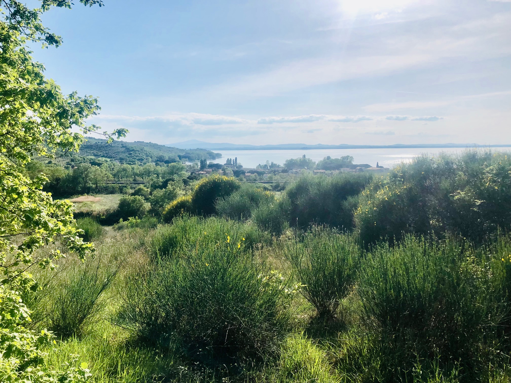
Closing in on Lago Trasimeno
The last climb through Magione to the Lago Trasimeno runs again through verdant country-side and is a welcome relief. I enjoy the sunset from the balcony of the hotel, well aware that it might be the last for some time as the weather forecast for the next few days is not good. A front is approaching from the South-West bringing rain and cooler temperatures.
Day 4: Lago Trasimeno to Vaiano
156km750m ↑
The track on google maps
It starts to drizzle half an hour in. It's soon strong enough that I need to don my rain jacket and cover my rucksack. On two occasions I need to stop to seek shelter under a pine tree. Things are not looking great but as I move North away from the Lake, the weather thankfully clears. The low pressure system is in my back, but moving slowly northwards.
Most of today's ride is through the region of Tuscany, which starts just North of the Lago Trasimeno. As happens so often across borders - be they national or regional - the road conditions change abruptly, from bad to worse or vice versa. The border between Umbria and Tuscany, at least when crossed on the Strade Statale Trasimeno, is no exception. Already on the Umbrian side, the state road featured its fair amount of potholes, loose gravel and cracks. The Tuscan authorities must have concluded that they could not possibly match the quality of the Umbrians and instead of readying themselves for the contest, pulled out altogether and instead let the road fall into disrepair. Something similar repeats itself in myriads of variations between humans and organisations that are in close contact and in competition. If you think you'll lose anyway, better not bother fighting for the win. Instead build out your strengths elsewhere. And the Tuscans have plenty. On a sunny day, it's hard to picture more gorgeous landscapes to cycle through. Especially between Arezzo and Florence as the road winds itself through rolling hills - more about that below.
Finding the optimal line on a treacherous piece of road with rain and lots of traffic is not at all straightforward. 'Keep to your right' is a valuable maxim but there's often a meter or so of road width to play with (the less traffic the more road). How to traverse that space of possibilities depends on what you want to achieve, and most objectives are composite, something like "I want to reach my destination without injuries, without punctures and in as little time as possible.". When there is yet another obstacle ahead (a stretch of loose gravel, shards of glass, a puddle of a depth unknown), one can either swerve around thus risking a collision, or find the next best line through or over it (the puncture-prone option). The first option can be combined with a slowing down (or speeding up) such that one reaches the obstacle at a more opportune moment (which in the long run can be quite energy-sapping). Factor in the speed and type of vehicle (is it just a small three-wheeled truck like the famous Piaggio Ape, or a massive lorry which on collision would most definitely spell the end) and you may as well give up and go home. Amazingly, while it requires a conscious effort at first, solving these knotty optimisation problems quickly becomes second nature.
It's a Sunday and most places are closed. There is also a disconcerting shortage of bakeries along the road, in fact a total lack thereof. Just when I resign to the idea of running on reserves for the rest of the day, up pops this place. Day saved.
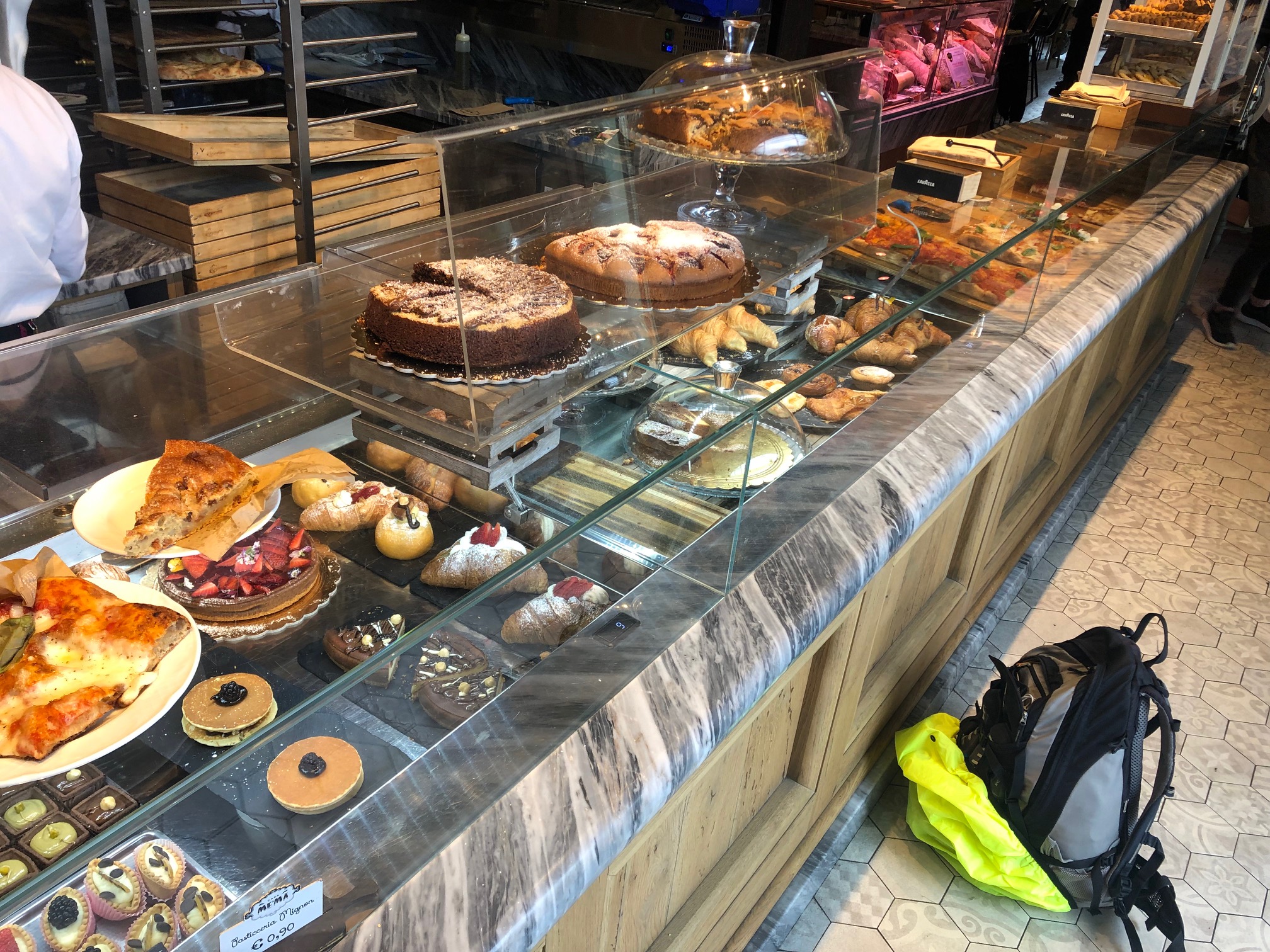
Just when I thought I would go hungry for the rest of the day.
After Arezzo, the road largely follows the Arno river. One can in fact follow the river all the way into Florence but both the motorway and a provincial road take a shortcut through the rolling hills East of Florence, the motorway steadily climbing and then descending, the provincial road almost compulsively visiting every hill-top village in the region. The climbs are steep but mostly short. The exception is the final one to San Donato in Collina which extends over 2km and has some pretty steep sections in it. After that it's a glorious descent into Florence.
Climb San Donato in Collina
I arrive in Florence with the sole purpose of getting out again on the other side. The town center is packed with tourists and it's an hour or so until I negotiate my way through the crowds, then through the Parco delle Cascine to leave the river Arno at the Ponte all'Indiano. From there I have to ask my way to Prato. The answers vary between. 'Oh, that's too far away' to 'I don't know. Perhaps this way'. Finally I get onto the Via Pratese and then the Via Firenze and 20km later arrive in Prato. It looks close on the map, but it's indeed quite a drag along big, busy roads.
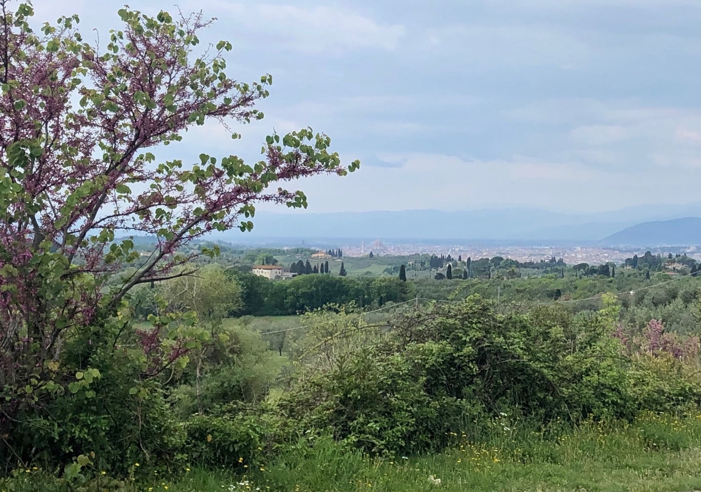
First glimpse of Florence on a rainy day
It's warm and sunny by the time I get into Prato. Lago Trasimeno feels a world away. Prato is quite pretty and on a Sunday evening buzzing with life. I stop in a quiet side road for a light evening snack, the leftovers from the day, before making my way into the hills via the SR325. My attention shifts to the task of finding a place for the night. Bologna is on the other side some 100km away, far out of reach for today so it would have to be somewhere in those hills.
But accommodation is scarce. The collected recommendations from booking.com and google maps come to four or five places. One hotel is right along the road but it seems closed. After half an hour, my phone call finally gets answered. "No more rooms for tonight, sorry". It dawns on me that it might take a while tonight. As I reluctantly continue up the road I begin to scan my surrounding for places to suspend my hammock. The idea of continuing through the night, as I had done on many occasions in the past, crosses my mind. But I am not in the mood. Two or three agriturismos are scattered across the hillside left and right, but quite high up and I cannot reach anyone by phone. Going back to Prato would be a safe bet but would mean time and effort wasted now that I have gotten to Vaiano.
I cycle on because I am not sure what else to do. Into the next village. Was that a grocery? On a Sunday? Well, let's get some food then. The place, a run-off-the-mill bar as there exist millions, is well frequented by a few men. Once I have ordered the first of a few cheese sandwiches and sit down, I notice just how exhausted I am. In passing I ask the assembled crowd whether they have any idea where one could possibly spend the night? One place comes to mind, a friend of a friend, back a few kilometers and then up a little lane into the hill. A glimmer of hope. The bar's owner calls his relation and arranges everything. The Casa le Bandite would be my home for the night. I arrive after sunset and rejoice at the news that their restaurant is still taking orders.
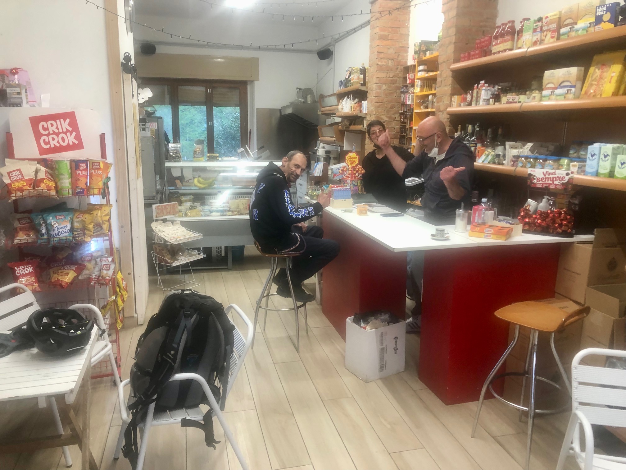
Saved by the locals.
Day 5: Vaiano to Verona
210km780m ↑
The track on google maps
It's a nationwide public holiday today, Festa del Lavoro or labour day as we know it. Perhaps the reason why the place offered no breakfast that day. But I had consumed untold quantities of food the night before, including a chunk of donkey cheese from Sardegna, a specialty of the house, enough for a long day ahead. Still, a simple coffee would have been great. From Vaiano, the road climbs for 20km to just above 770m, fairly gently apart from a few bends towards the top. By 10am I cross over from Tuscany to Emilia Romagna and begin the 50km descent towards Bologna. It's unusually chilly under a gray sky and it's only when I reach the valley floor at Forno, and after having downed three cappuccini at the Bar Ponte 20km into the descent, that I begin to feel comfortable.
Whenever the road comes into bigger towns like Casalecchio di Reno or Borgonuovo, I tend to lose track of the route and lose an hour or so getting through city centers and off motorways. I am relieved when, all the hills behind me, I am finally on the dead-straight SP568 with a sign for Verona.
The feeling on the bike is nothing short of amazing. The gain in strength from four days of exercise is remarkable and so is the endurance. I can sustain a decent speed for the next few hours without tiring or constantly craving sustenance. I am still not sure whether I would be able to go all the way to the foot of the Alps, if only because there were only so many hours left in the day and I was still well South of the Po river.
Outside what seemed to be the only open cafe in Camposanto, the Bar San Pietro, two gentlemen with their e-bikes parked on the side suggest that instead of continuing on the road I should better jump onto the bike lane that follows the rail line almost all the way to the Po river. It's the Ciclovia del Sole and it is, they assure, me eminently rideable on a road bike. I duly follow their advice and indeed find a well-prepared bike path with a surface part paved part very fine gravel. Convenient, but also uninspiring: for 20-30km it's all rail tracks on one side, shrubs on the other and rarely a view beyond into the distance.
What breaks the boredom are the handful of towns along the way. The path joins the local roads around town and then it's back hugging the rail lines.
At Poggio Rusco the path stops. It's work in progress I understand. The fairly rough Via Pinchazo or was it Pinzone leads back onto the main road. I survive without puncture.
Once across the Po river, the road up to Verona is very smooth and fun to ride. The surface is incredible and seems only to be getting better. The sky is largely cloudless and in the North the first foothills of the Alps
become visible. Benign looking cumuli frame the view along the horizon. 30km outside of Verona, with my energy levels suddenly precipitously low, I stop at a non-descript roadside hotel to ask for a room but get dismissed
in less than friendly a manner. How stupid to even consider not going all the way. After more than 200km, I finally reach Verona at dusk
in a state more of elation than exhaustion, and thank the universe that things had gone so smoothly.
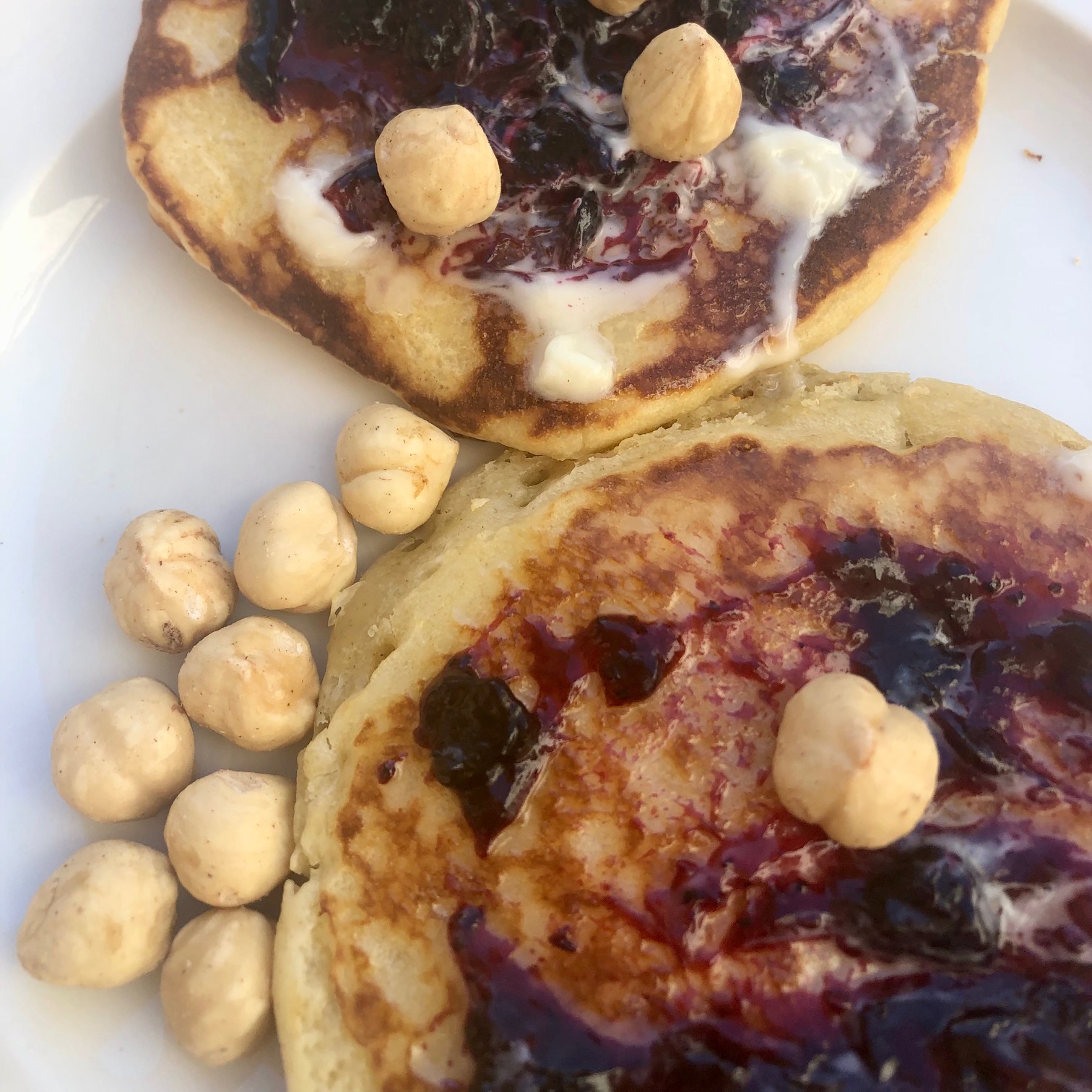
At last. Pancakes never tasted that good.
What are the learnings?
- Don't bother bringing a hammock. Make do with what you find along the way. The 30min siesta was definitely nice but not worth carrying an extra pound all across the country.
- Be in better shape before the trip. Having a bit more strength and lot more endurance would make the first two stages that much more enjoyable.
- Do it all again but this time along the other side - say from Puglia to Venice.